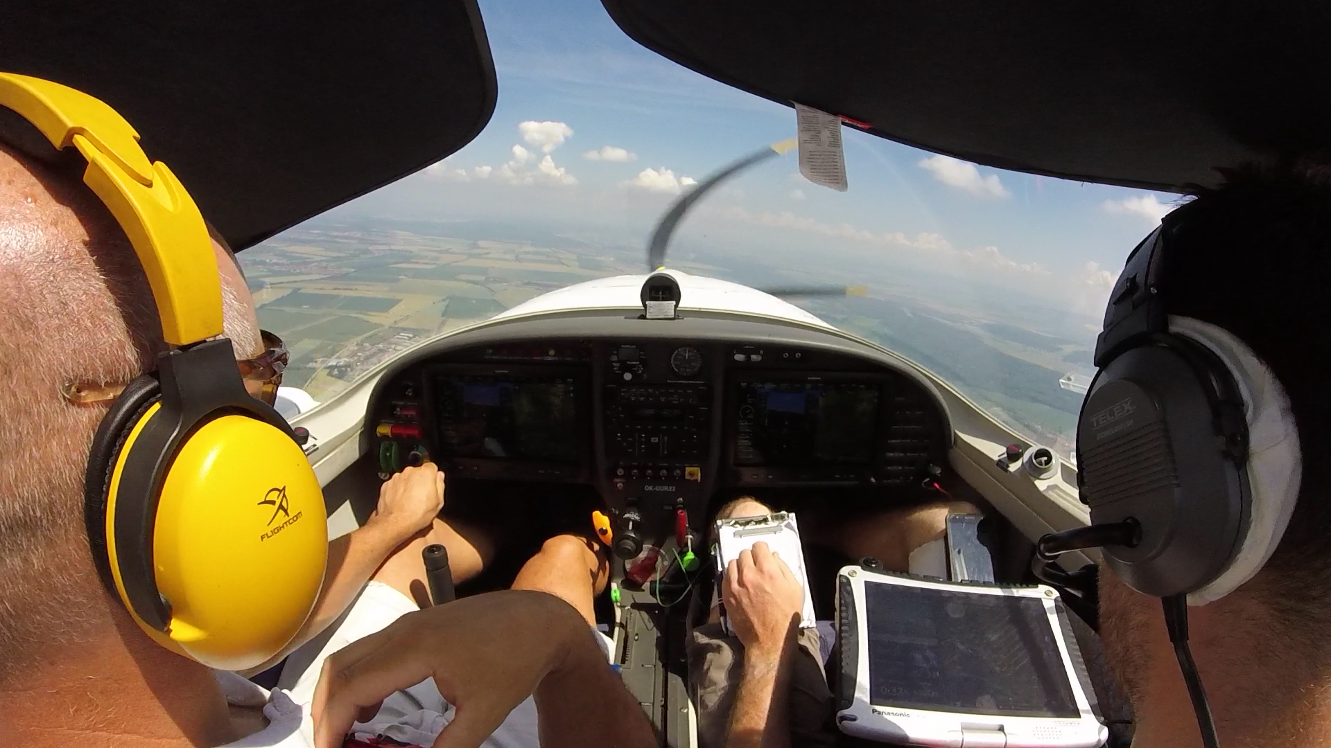
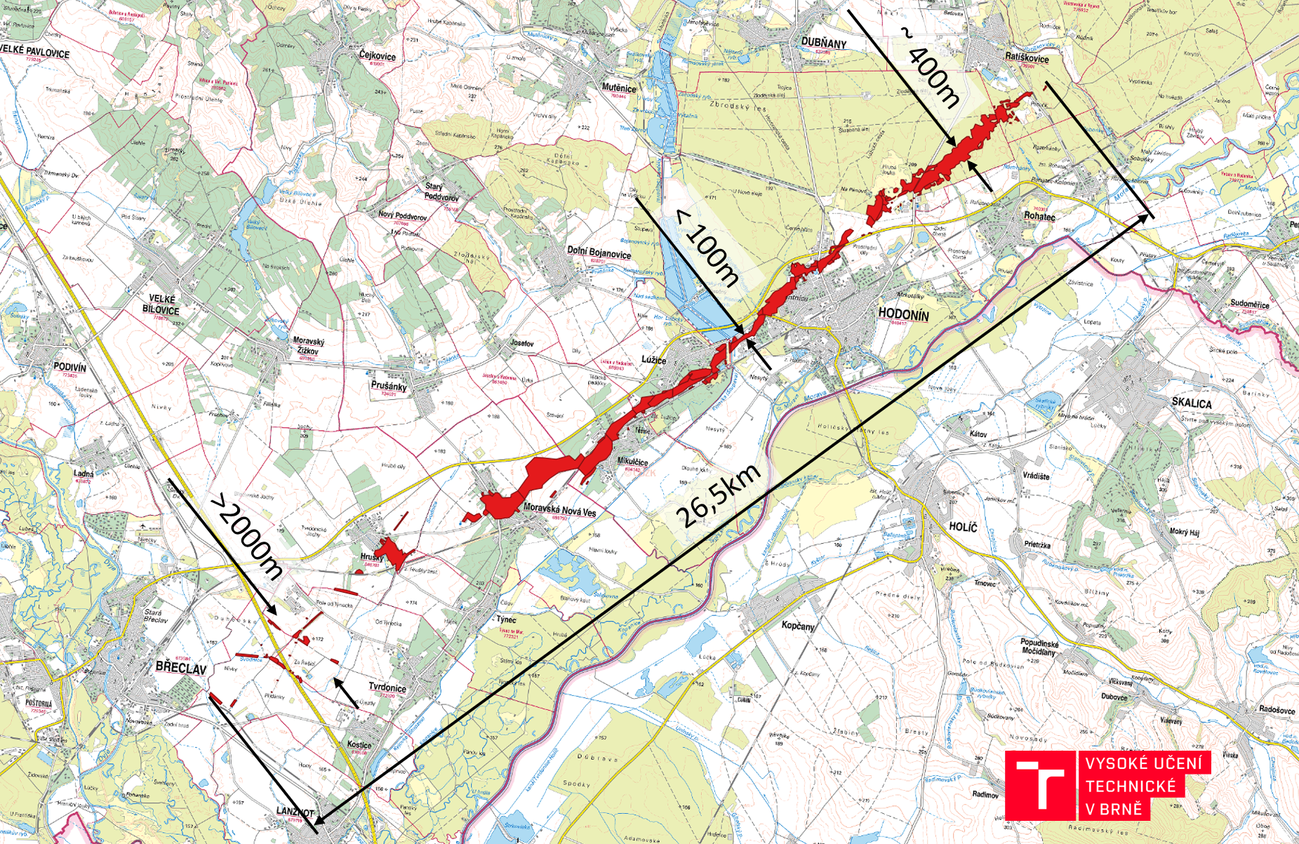
On Thursday, June 24 2021, south part of Moravia has been hit by the strongest recorded tornado in the history of the Czech Republic. We have mapped the affected area less than 24 hours after the catastrophe from a manned airplane using a SFM photogrammetry workflow typically deployed from our small UAVs. We have processed the data during the night and the results are in operational use by first responders both in the field and at the command center since Saturday morning.
UPDATES:
2021/06/27 second mapping campaign with considerably improved illumination – Sunday afternoon. The resulting orthophoto is of higher quality and covers larger area
2021/06/30 the dataset has been made freely available for non-commercial use
2021/07/01 third mapping campaign based on the request from first responders
2021/07/16 fourth mapping campaign based on the request from first responders
Basic metadata:
1. campaign: Friday 25.6.2021 19:20 – 20:16 CEST
GSD 21cm/px; flight height 1000m AGL
Mapped area 94km^2, 369 aligned photos
Nominal sidelap/overlap 40%/40%
Results: https://owncloud.cesnet.cz/index.php/s/NkHWIhlq0lEdsHS
2. campaign: Sunday 27.6.2021 12:53 – 15:30 CEST
GSD 18cm/px; flight height 850m AGL
Mapped area 180km^2, 2102 aligned photos
Nominal sidelap/overlap 40-80%/40%
Results: https://owncloud.cesnet.cz/index.php/s/tOaV4pYwWpU8Gcs
3. campaign: Thursday 1.7.2021 09:17 – 11:15 CEST
GSD 18cm/px; flight height 850m AGL
141km^2, 1506 aligned photos
Nominal sidelap/overlap 40/80%
Results: https://owncloud.cesnet.cz/index.php/s/JndW7nkpremWlYa
4. campaign: Friday 16.7.2021 10:10 – 11:22 CEST
GSD 18cm/px; flight height 850m AGL
149km^2, 1597 aligned photos
Nominal sidelap/overlap 40/80%
Results: https://owncloud.cesnet.cz/index.php/s/xWtMKcqFqdCNJQz
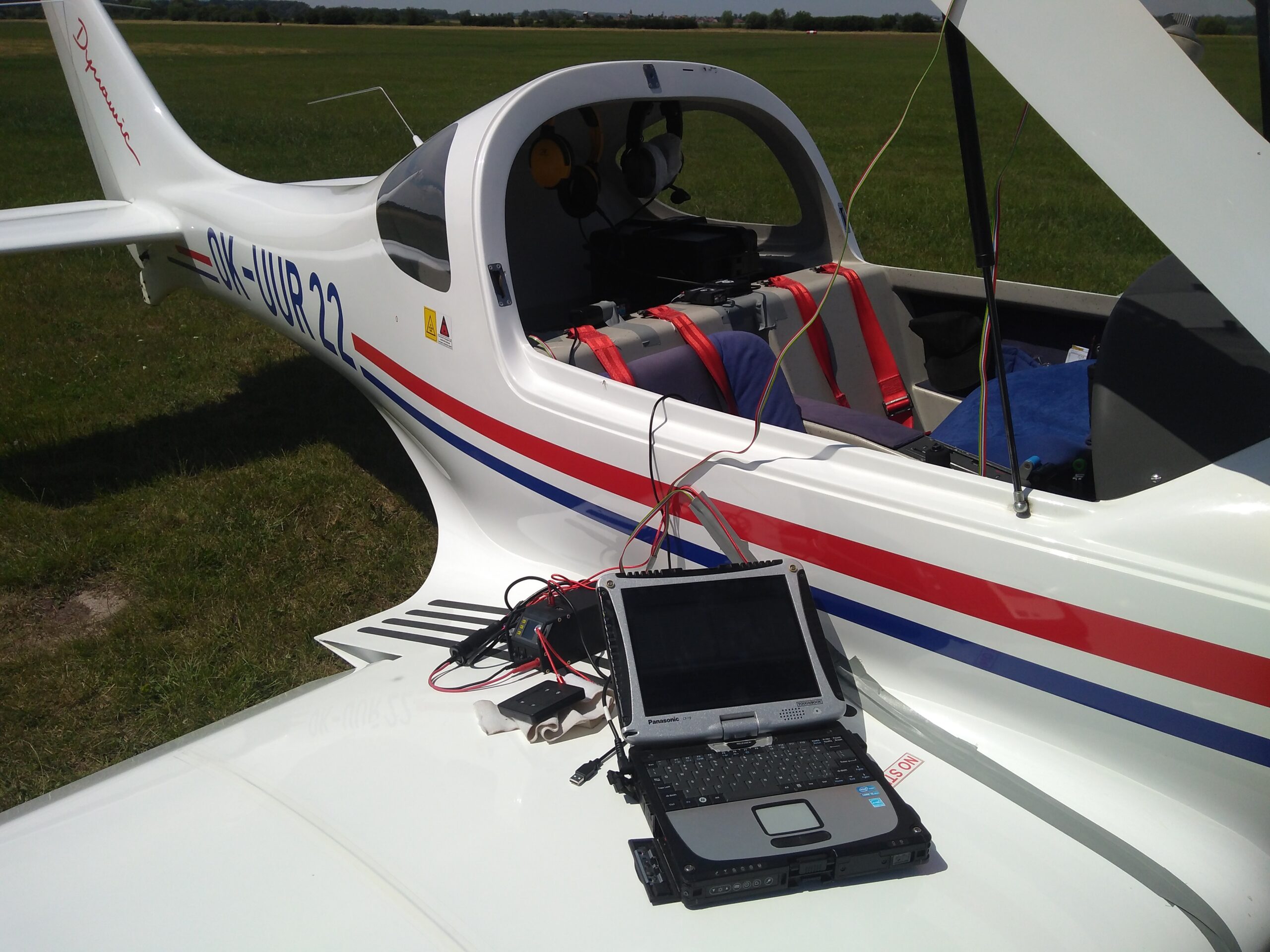
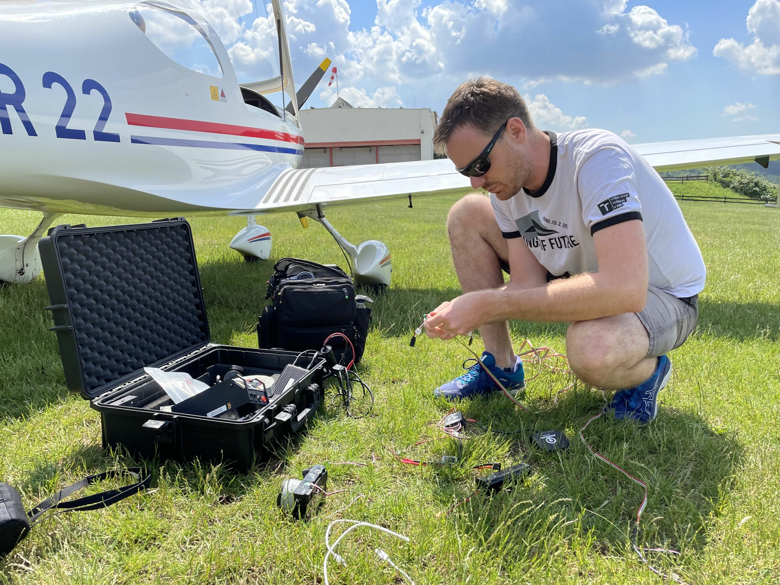
Aircraft OK-UUR22
Sony Alpha A6000 + Sony E20/2.8
Pixhawk 3 Pro + GPS uBlox F9P
Author Petr Dvořák
Pilot Ivo Jebáček, Mirek Červenka
Support Tomáš Hájek
Impulse Robert Popela
Production Jaroslav Juračka
This unique dataset is available free of charge for non-commercial purposes. We are publishing the dataset in a good will to help the disaster response and support the tornado research. We will be grateful if you can share how you use the data – please write to dvorak.p@fme.vutbr.cz
Maps created from the dataset – A0 format (pdf, 60MB):
The tornado trace overlay on base map together with all ortophoto footprints (we have tried to map the core of the destroyed area – the main criteria were lying trees, destroyed roofs and visible traces on bare ground – obviously, the area affected by the storm is much larger):
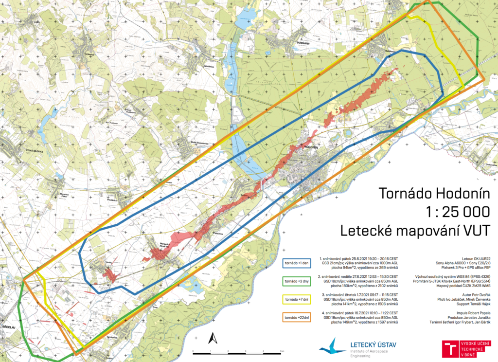
Tornado trace is available as a shapefile: https://owncloud.cesnet.cz/index.php/s/NiUotTuucUExcX0
Gallery:
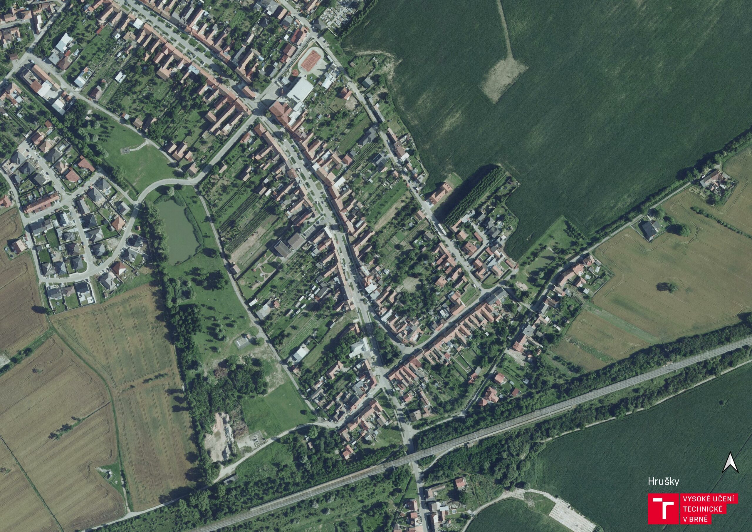
Hrusky before 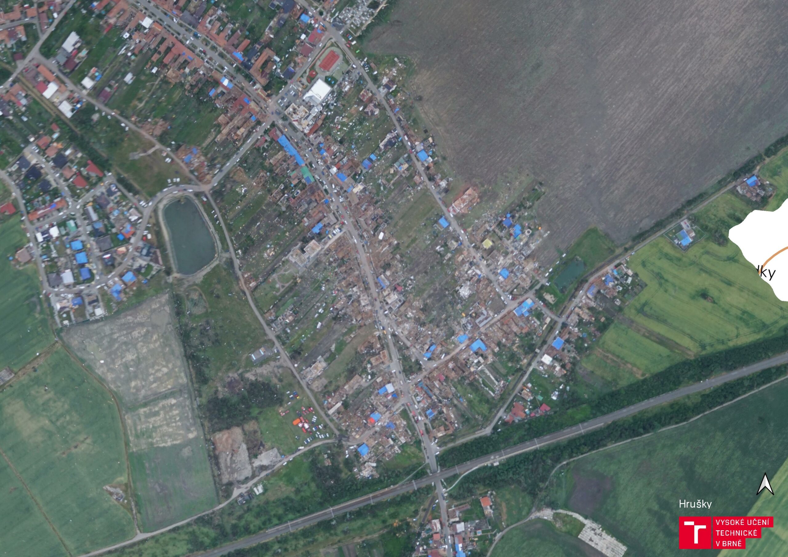
Hrusky +1day 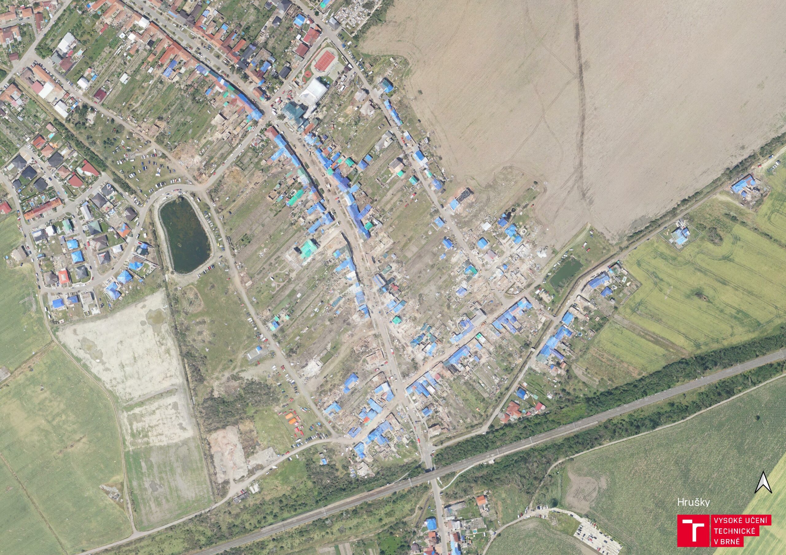
Hrusky +3days 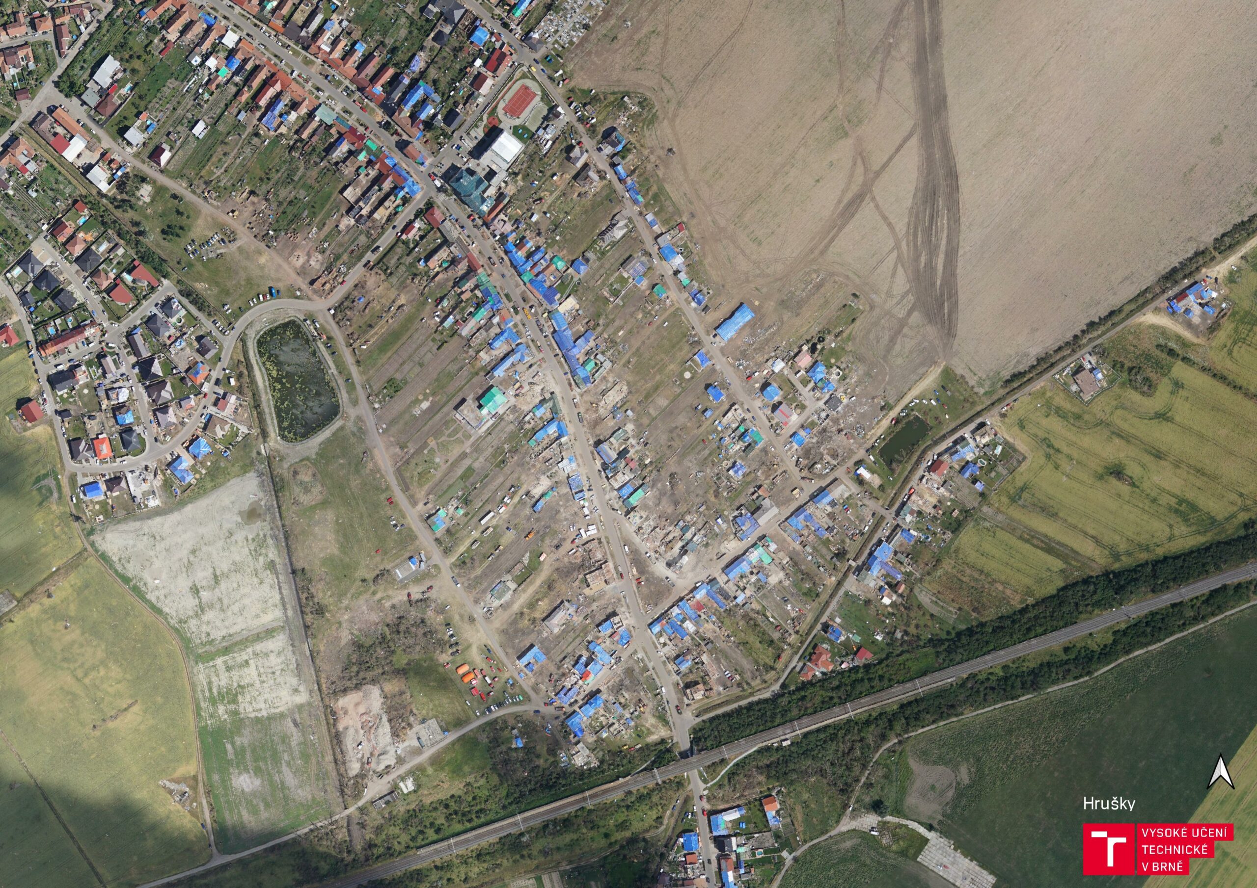
Hrusky +7days 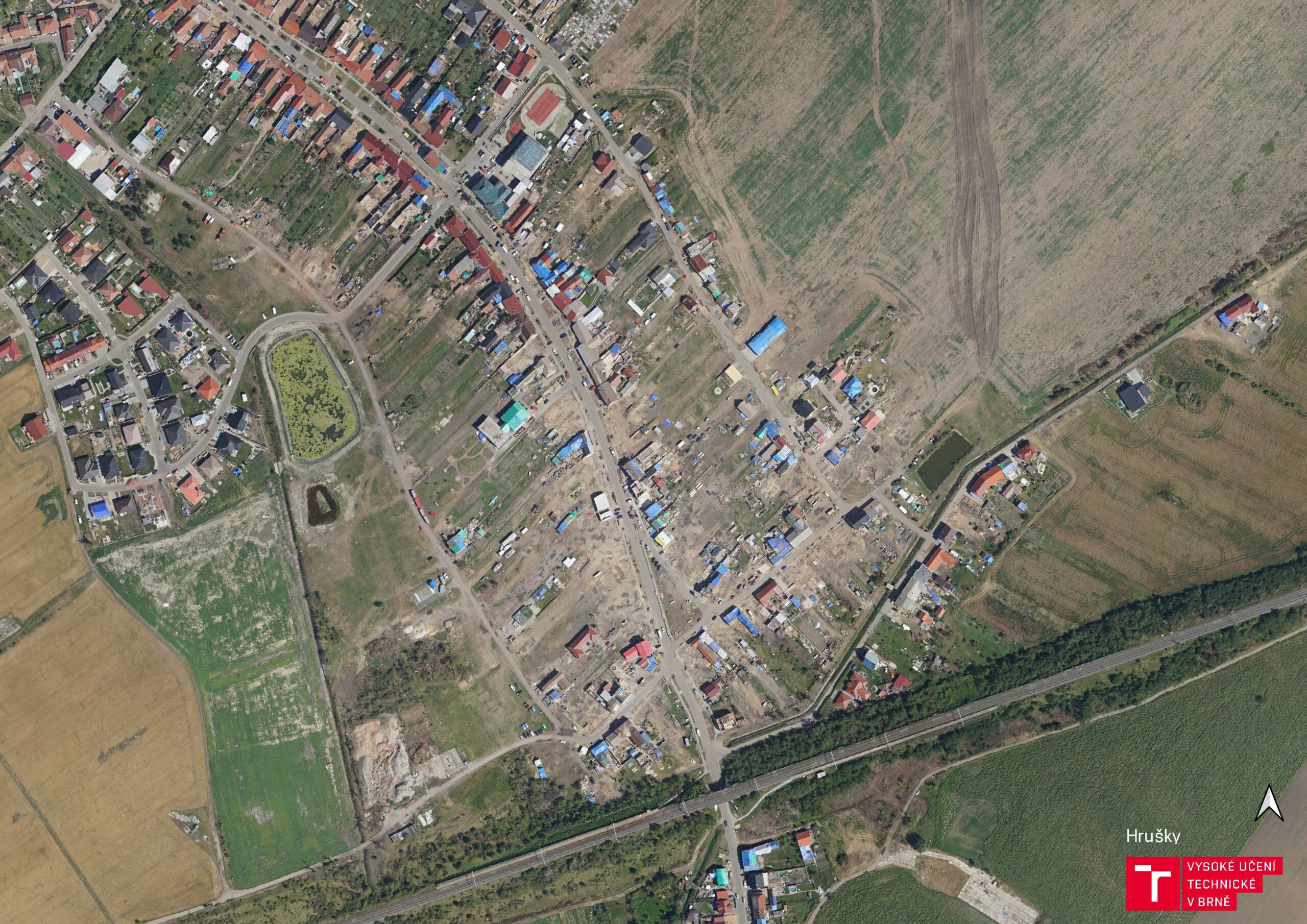
Hrusky +22days 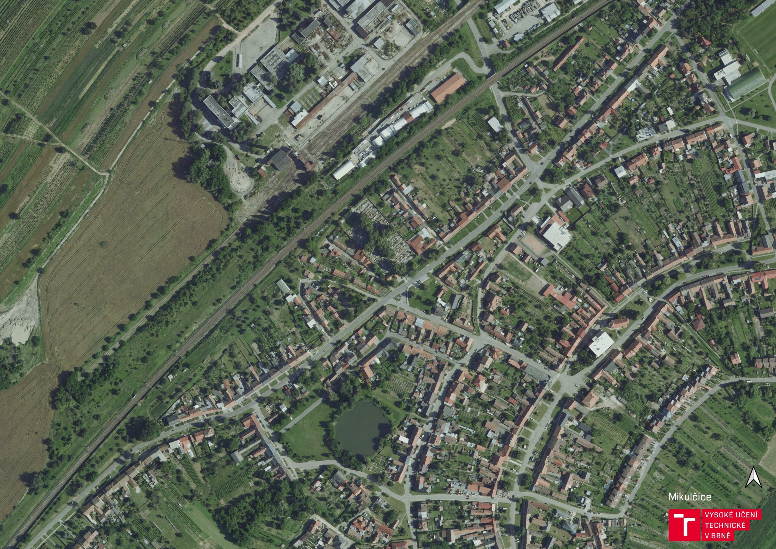
Mikulcice before 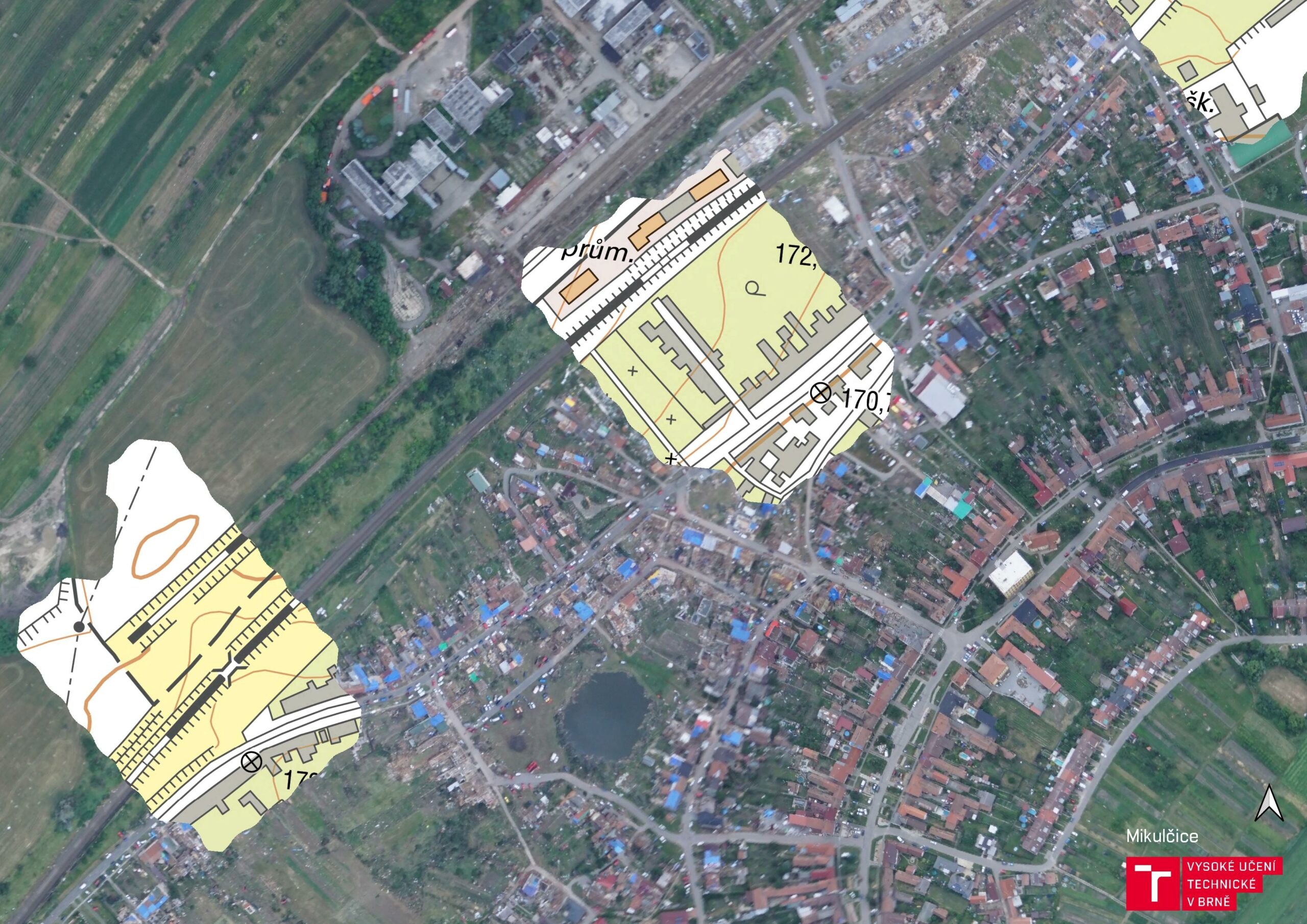
Mikulcice +1day 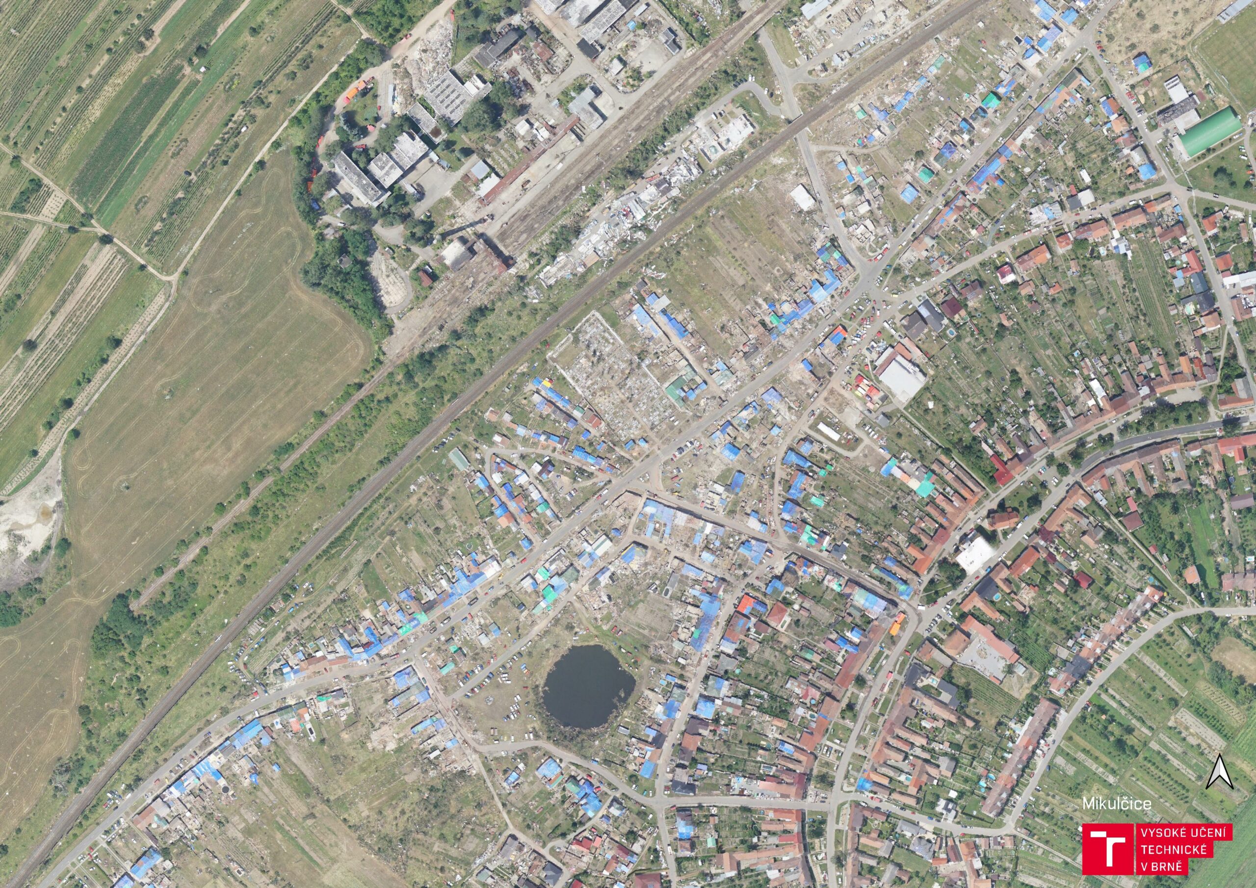
Mikulcice +3days 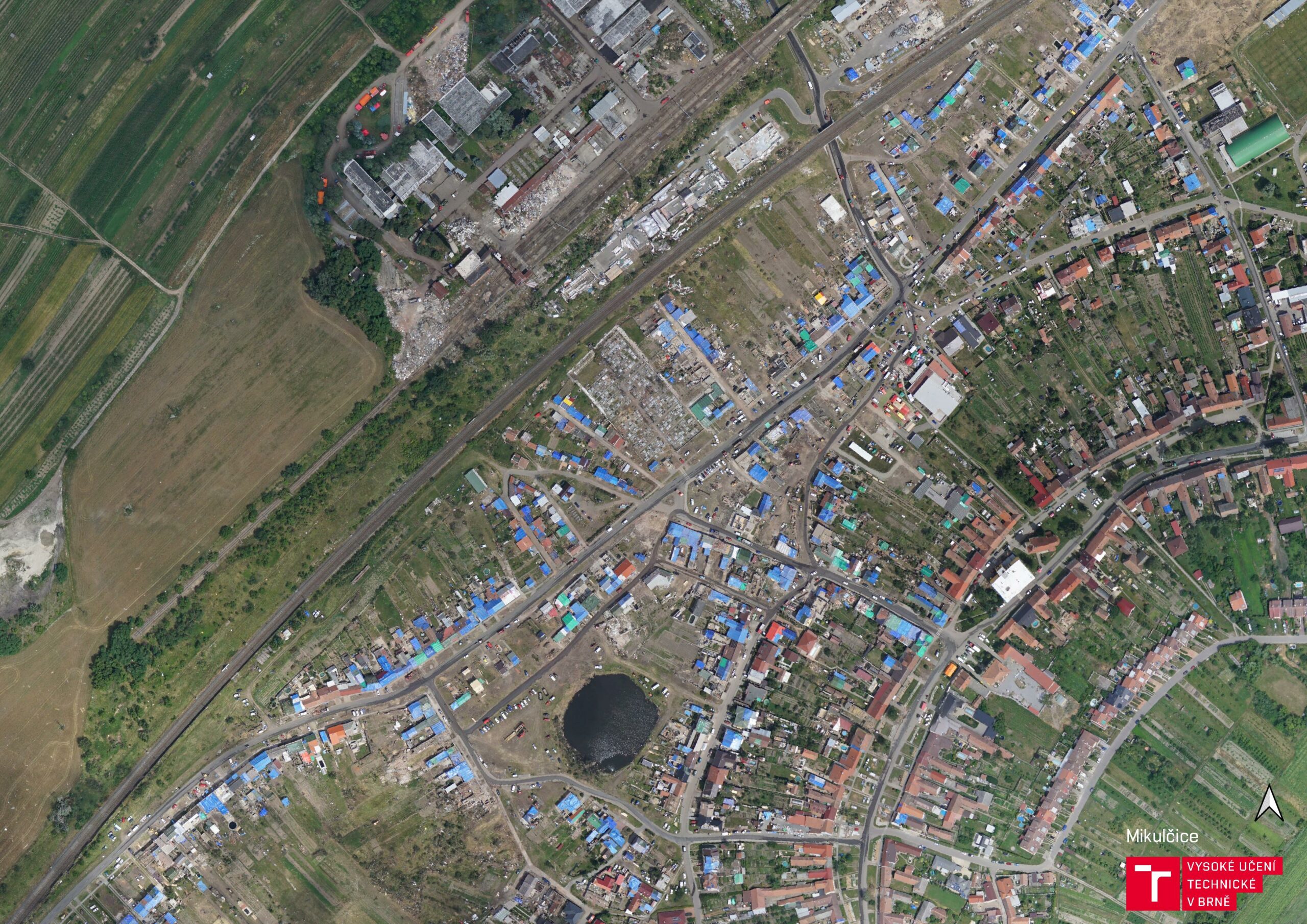
Mikulcice +7days 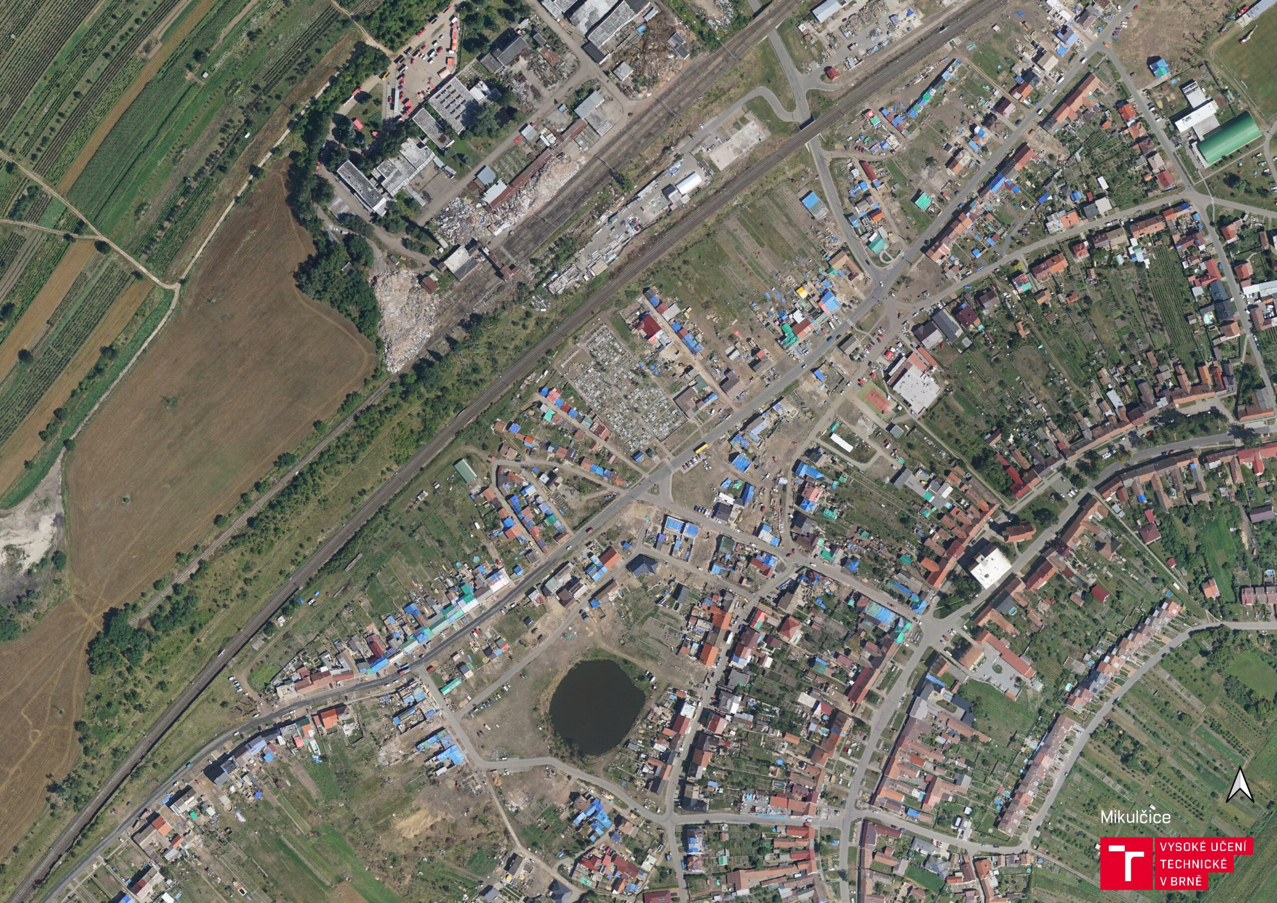
Mikulcice +22days 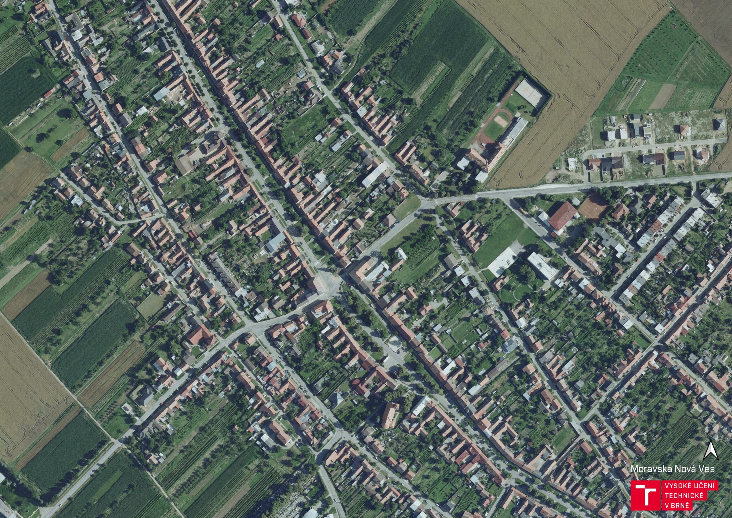
MNV before 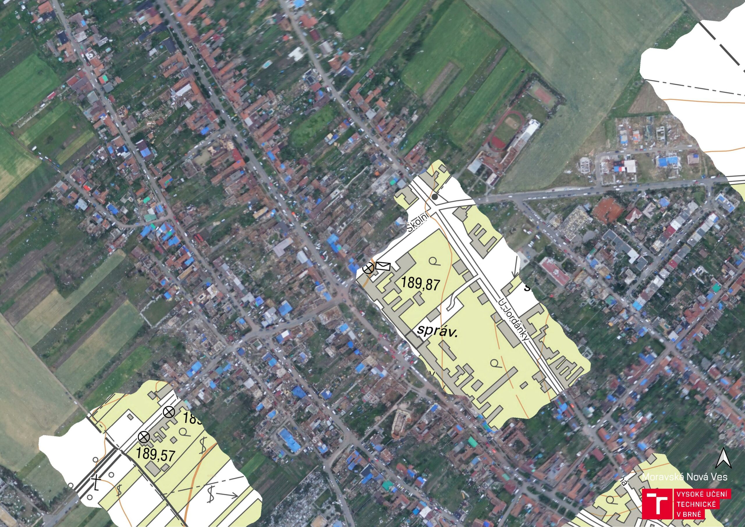
MNV +1day 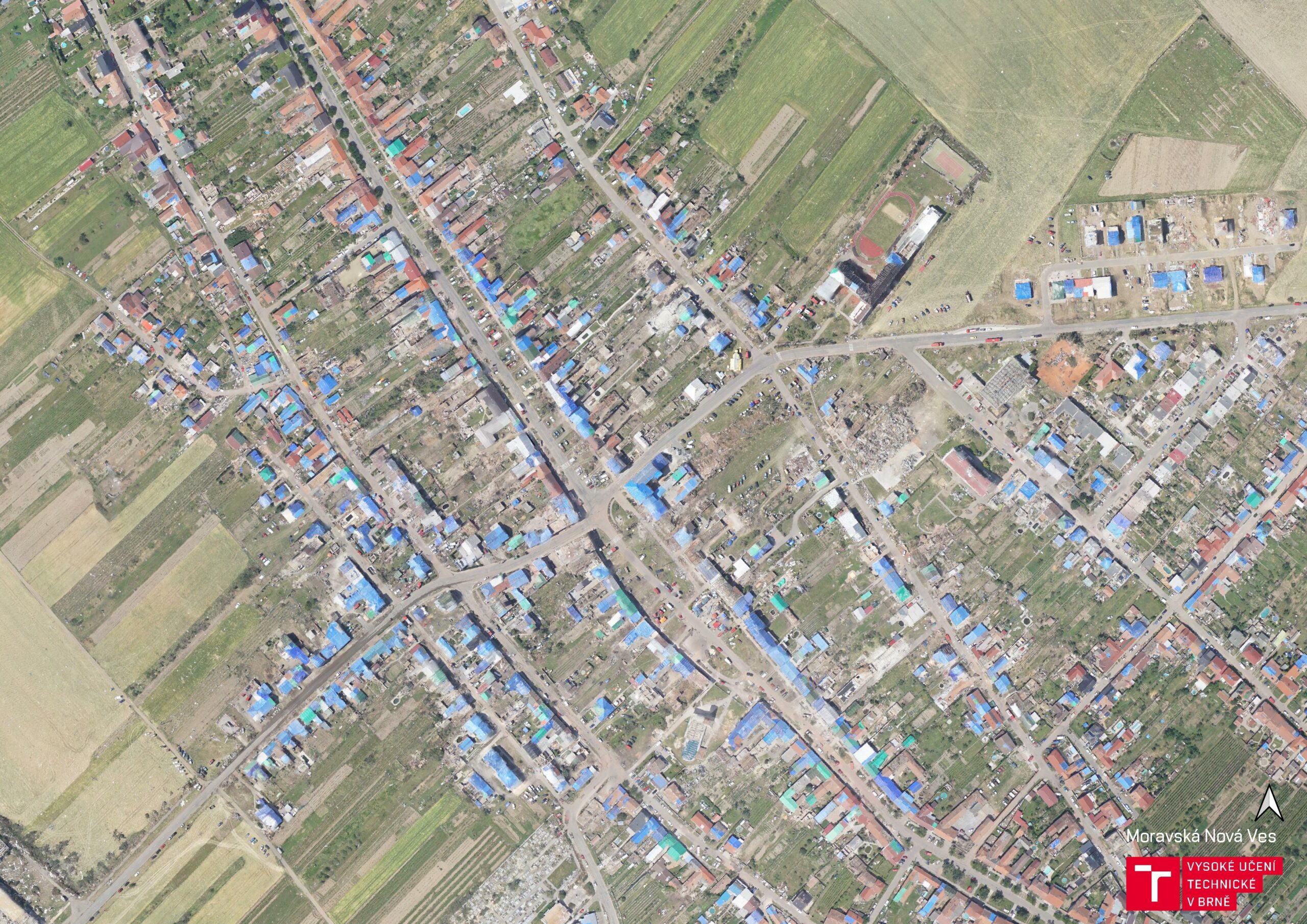
MNV +3days 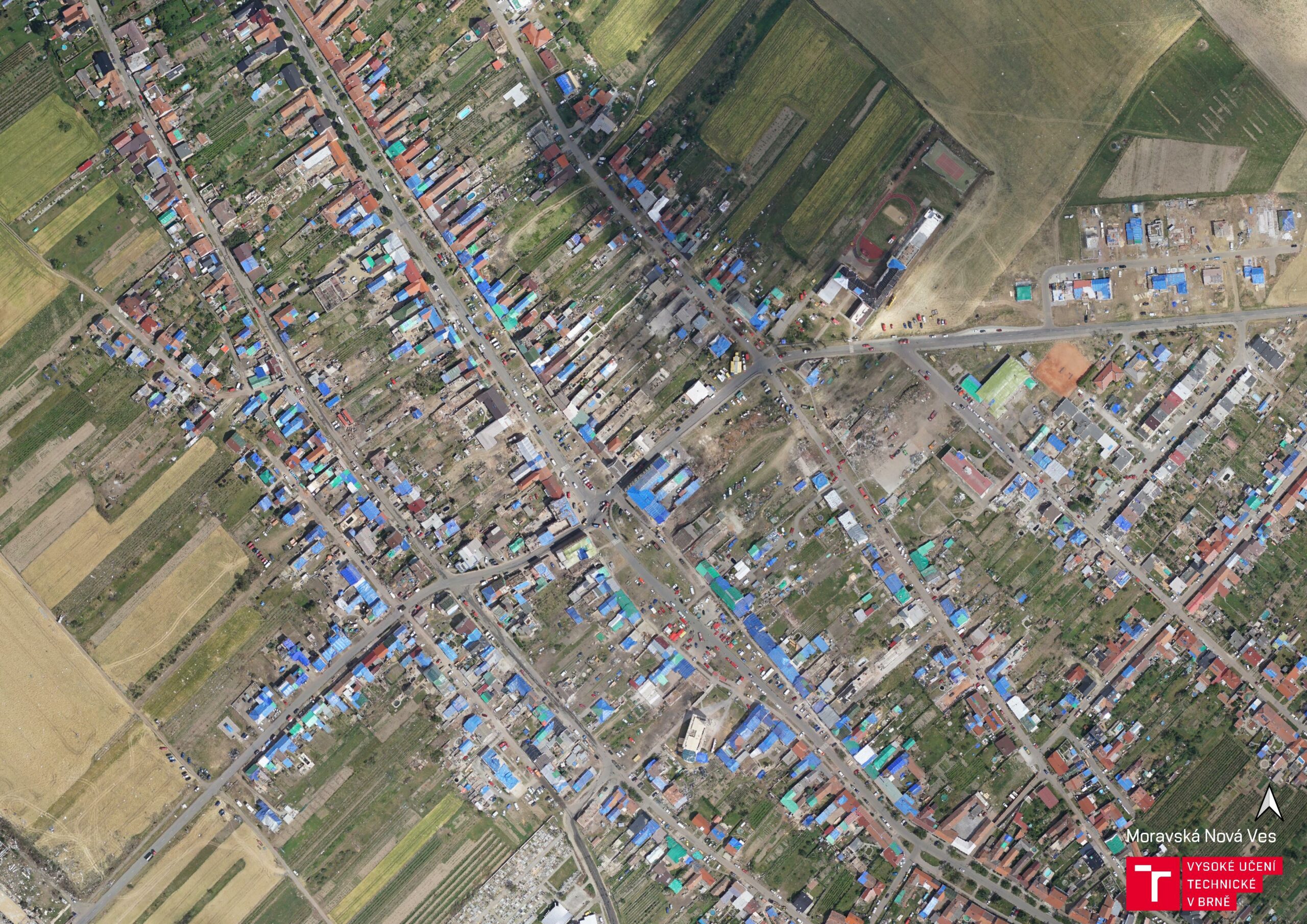
MNV +7days 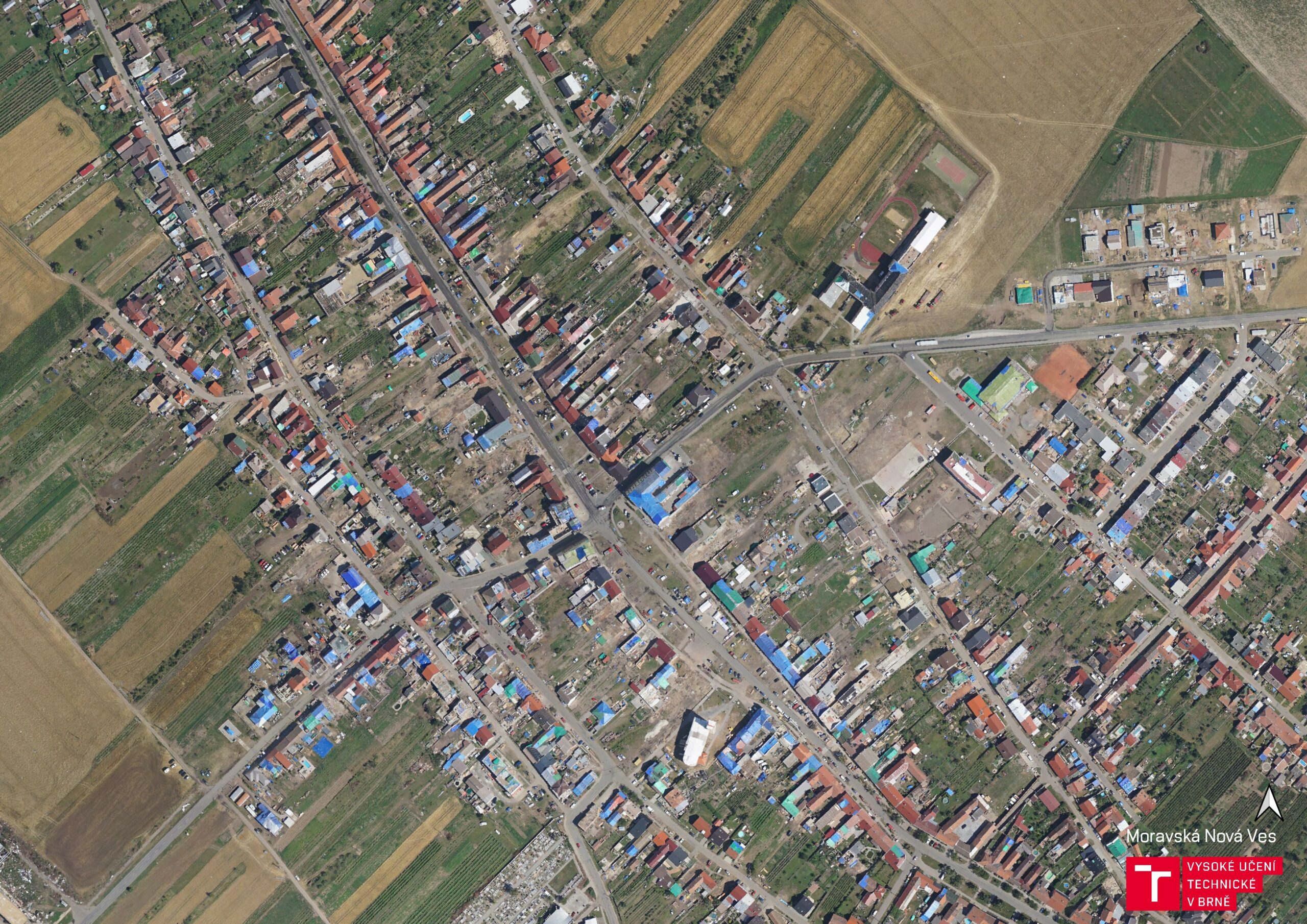
MNV +22days 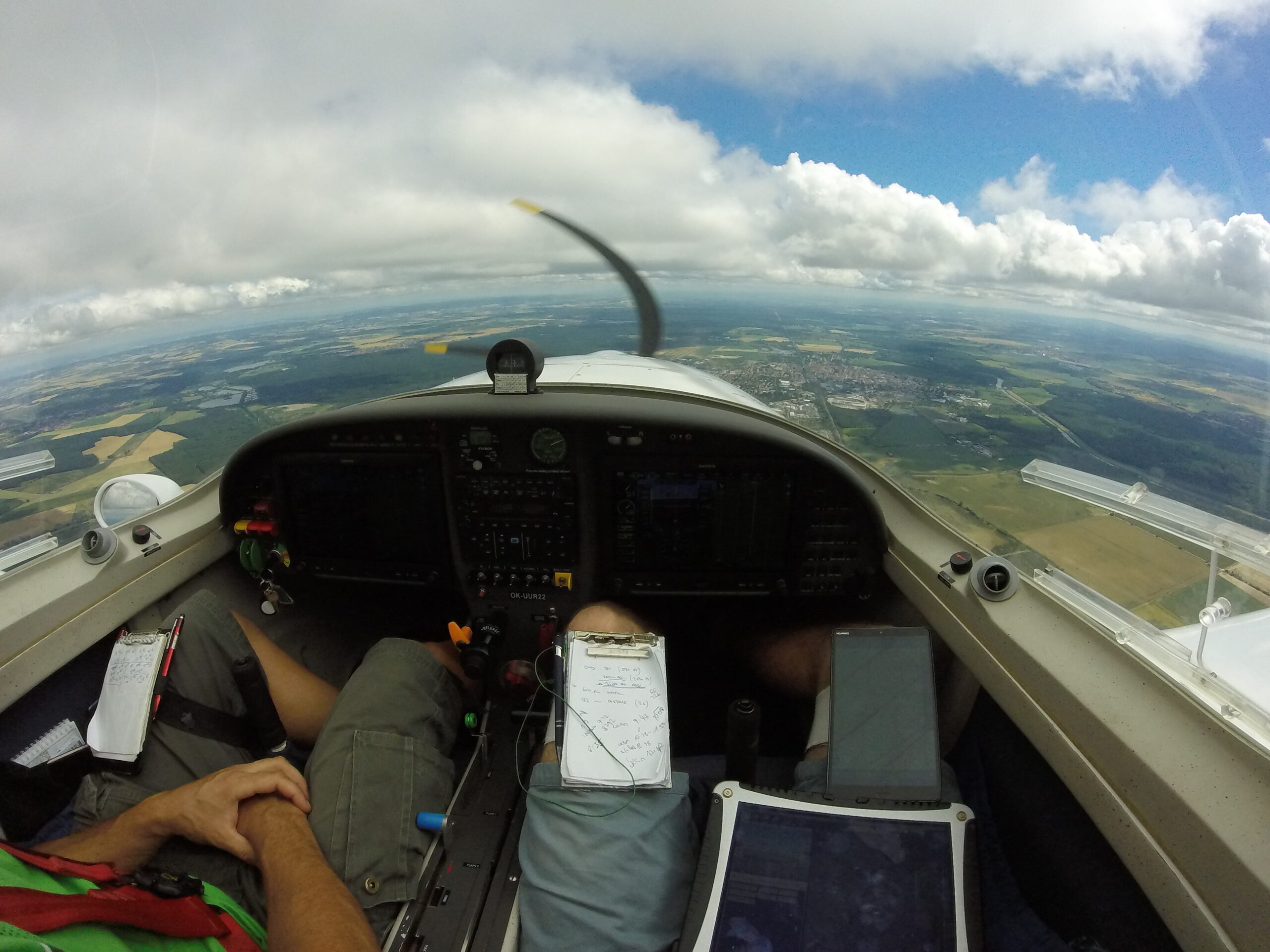
Trace measurement